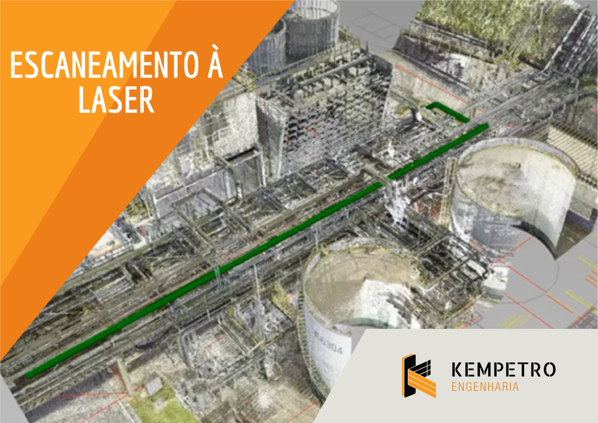
Innovation is in the DNA of Kempetro, which continues to advance in the search for new ideas. In the era of Engineering 4.0, the market is increasingly dynamic and the processes follow this evolution. One of the tools used in the company’s projects is Laser Scan, measurement technology and high precision three-dimensional scanning.
This feature is capable of capturing images of an entire area in three dimensions. All elements are scanned and transformed into a clear, high-quality digital model that can be accessed from the computer. With a measurement rate of up to 2 million dots per second, the model acquired by Kempetro creates colorful 3D point clouds in less than two minutes.
Essential in Brownfield projects – when there are already existing installations on the ground where the project will be developed, laser scanning guarantees the mapping of the area in a faster, safer, cheaper and more accurate way, being beneficial for both Kempetro and its collaborators, as for the client. In addition, its use reduces the exposure of employees to risky situations.
The tool has already been applied to 22 projects, and Kempetro employees, distributed on the various sites of client companies, have participated in training on how to use the tool according to demand. This technology also allows the point cloud creation process to be quite different from the traditional way. “The traditional way is to take a measuring tape to the field and perform the measurement, drawing the isometric or the item to be surveyed in the field in a manual drawing and, subsequently, drawing in the 3D software. Some problems may occur in these measurements, such as lack of access to certain locations, high points, making it impossible to perform the As-built ”, explained Thiago Peres, Manager of the Department of Integrated Systems for Engineering / Innovation (SIEI).
The technology is integrated with Building Information Modeling (BIM) 3D, 4D and 5D, which generate accurate and detailed models from the point cloud. The measurement with Laser Scan, according to Peres, allows other gains, such as the integration between the project and the current situation of the field; the removal of measurements and dimensions at any time, from the 3D image, without the need to return to the field; better planning and less material loss; simulation and assembly planning and easy visualization and comments from those involved with the project.
4 comments